Climate Mapping for Resilience and Adaptation, Climate-related hazards in real-time.
Climate Mapping for Resilience and Adaptation (CMRA) integrates information from across the federal government to help people consider their local exposure to climate-related hazards. People working in community organizations or for local, Tribal, state, or Federal governments can use the site to help them develop equitable climate resilience plans to protect people, property, and infrastructure. The site also points users to Federal grant funds for climate resilience projects, including those available through the Bipartisan Infrastructure Law.

Does your community face any of these hazards?
Climate-related hazards are impacting people and infrastructure. In many areas, the impacts of these hazards are projected to worsen. Planners, local project leaders, and other users can find some of the best-available Federal information on these hazards in the CMRA Assessment Tool below.
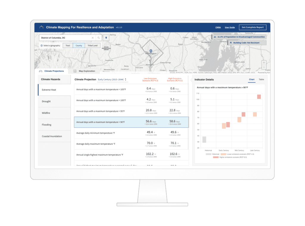
CMRA Assessment Tool
The CMRA Assessment Tool provides information on past, present, and future climate conditions. Use it to understand exposure in your area so that you can effectively plan and build more resilient infrastructure in your community.
Launch the CMRA Assessment Tool
Start developing your climate resilience plan
Climate resilience is built at the local level. Communities can combine detailed climate exposure information from CMRA with local environmental, social, and economic data to address their unique needs for equitably and inclusively building climate resilience.
Source: CMRA
![]()